»Events Calendar»Highway Conditions»Highway Webcams»Movie Theaters»Weather Forecast»Reno Webcams»NewToReno Blog»Site Map |
Reno Area Highway & Road Conditions
Search NewToReno

Valentines Day |
|
|---|---|

|
Treat your sweetheart on Valentine's Day. |
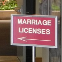
Get a Marriage License |
|
|---|---|

|
How to get a Nevada marriage license. |
Reno Area Senior Services |
|
|---|---|

|
Explore what's available for seniors in the Reno area. |
Nevada has around 50,000 miles of roads, streets, and major highways. Because of Nevada's mountainous terrain and Great Basin climate, it is wise to be informed about both highway conditions and the weather forecast before venturing far. This is particularly true in winter, when severe weather can temporarily close both major and secondary highways.
Highway Conditions links:
»Nevada |
»I80 |
»US 395 / I580 |
»US 50 |
»SR 88 |
»SR 89 |
Caltrans and NDOT Live Highway Webcams:
Lake Tahoe area / Sierra Nevada Webcams
»I80 at Floriston»I80 at Truckee scales
»I80 at Donner Lake Interchange
»I80 at Donner Summit
»I80 at Soda Springs - Eastbound
»I80 at Soda Springs - Castle Peak
»I80 at Kingvale - Eastbound
»I80 at Kingvale - Westbound
»US 50 at S. Lake Tahoe
»US 50 at Meyers / Luther Pass Road
»US 50 at Echo Summit
»US 50 at Twin Bridges
»SR 89 at Olympic Valley
»SR 89 at SR 28, Tahoe City
»SR 28 at SR 267, Kings Beach
(information from Caltrans and Nevada Dept. of Transportation [NDOT])
Snow Chains for Winter Driving
Traveling in winter and need snow chains? Check out LesSchwab.com for a great selection of tire chains and tips on how to use them correctly.
Highway Conditions Information:
The closest large metropolis to Reno is Sacramento, CA. A nearby major Reno playground is Lake Tahoe, which straddles the state line. And lots of people have friends, relatives, and business in California. Therefore, we are including contact information for both Nevada and California highway conditions.
Nevada Dept. of Transportation (NDOT)
|
California Dept. of Transportation (Caltrans)
|
Sponsored Links
Sponsored Link
| Share NewToReno(dot)com | |||||
|---|---|---|---|---|---|
»Home »Contact Us »About Us »Privacy Policy »Disclaimer »Site Map
Copyright © NewToReno(dot)comTM