»Events Calendar»Highway Conditions»Highway Webcams»Movie Theaters»Weather Forecast»Reno Webcams»NewToReno Blog»Site Map |
Hiking the Tom Cooke Trail in Reno
Search NewToReno

May is Older Americans Month |
|
|---|---|

|
Events and activities for seniors all month. |
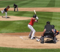
Reno Aces Baseball |
|
|---|---|
|
Fun at the ballpark with the Reno Aces. |
Restaurant Inspections |
|
|---|---|

|
Check scores on restaurants and other food establishments before deciding where to dine out. |
The Tom Cooke Trail is part of an urban trail system maintained by the City of Reno Parks, Recreation and Community Services Department. The popular Tom Cooke Trail is in west Reno, next to the Truckee River. The trail is open to hikers, mountain bikers, and equestrians (no motorized vehicles). Dogs are permitted, but they must be leashed and under control at all times.
The Tom Cooke Trail is not ADA accessible. Nearby, however, there is parking at Mayberry Park and a paved walking and biking path that goes both upstream and downstream next to the Truckee River.
Tom Cooke Trail and Beyond
The Tom Cooke Trail is only a short out and back - .6 mile, or 1.2 miles round trip. To make each direction a little different, look for a side loop trail as you ascend from the trailhead. You can take this either going out or on your return to add variety to the hike. Though the whole trail is short, it climbs a set of switchbacks starting right after crossing the Truckee River foot bridge. You gain a couple of hundred feet in elevation quickly and are rewarded with some terrific scenery.
You can keep going after reaching the top end of the Tom Cooke Trail. There is an intersection here with a trail that follows the Steamboat Ditch for many miles. You can hike or ride all the way to south Reno on this path, or go the other way to Verdi. Another alternative is to hike down into the canyon to the west and take the trail back to the trailhead behind Patagonia.
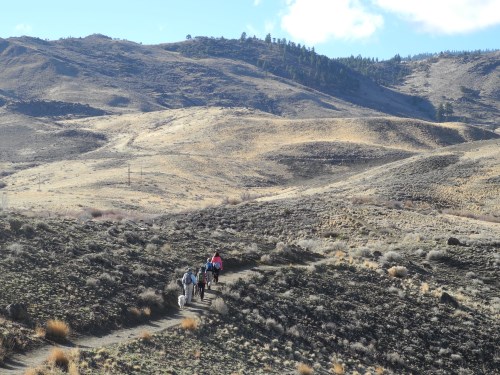
Hikers enjoying a walk and big views along the Tom Cooke Trail in west Reno, Nevada. Photo © Stan White
There are two other treats along Steamboat Ditch. One is called Hole-in-the-Wall, which is a tunnel dug through a hill as part of the ditch waterway. The other is a historic concrete "airmail arrow," one of many built during the early days of airmail service to guide pilots to landing fields. It is reached by climbing above Hole-in-the-Wall on an old dirt road and looking on a hilltop toward the Truckee River. This arrow directed pilots to Reno's original airmail field at what is now Washoe Golf Course along Plumas Street.
![]()
Hole-in-the-Wall and the airmail arrow above the Tom Cooke Trail in west Reno, Nevada. Photos © Stan White
Trailhead Parking for the Tom Cooke Trail
Two parking areas serve Tom Cooke Trail users. The official trailhead parking lot is reached from White Fir Street, which is a right turn off of Woodland Avenue. You cross the Truckee River and turn left into the lot behind the Patagonia Outlet, then look for the trail sign where the hike begins. An alternative is the parking area at Mayberry Park, which is at the end of Woodland Avenue.
From Mayberry Park, take the paved walkway (which is part of the Tahoe - Pyramid Bikeway) a short distance west to the foot bridge across the Truckee River to reach the trail. If coming from Reno, Woodland Avenue is a left turn from West 4th Street. The nearest restroom facilities are in Mayberry Park.
Sponsored Links
Sponsored Link
| Share NewToReno(dot)com | |||||
|---|---|---|---|---|---|
»Home »Contact Us »About Us »Privacy Policy »Disclaimer »Site Map
Copyright © NewToReno(dot)comTM